


Before you leave...
Take 20% off your first order
20% off
Enter the code below at checkout to get 20% off your first order
Discover summer reading lists for all ages & interests!
Find Your Next Read
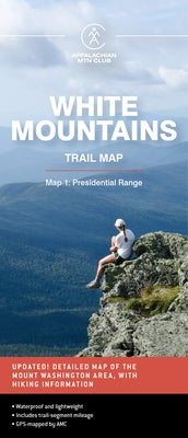
Waterproof and lightweight, this Presidential Range map includes detailed maps of the full Presidential Range, with an inset of Mount Washington. Printed in full-color on waterproof Tyvek, this fully updated map includes comprehensive trail coverage of the popular hiking region, as well as safety and planning tips and emergency information. GPS-rendered, this map is tear-resistant, has an easy-to-read scale, and includes trail segment mileage.
Not available to be shipped via Media Mail
Thanks for subscribing!
This email has been registered!
Take 20% off your first order
Enter the code below at checkout to get 20% off your first order