


Before you leave...
Take 20% off your first order
20% off
Enter the code below at checkout to get 20% off your first order
Discover summer reading lists for all ages & interests!
Find Your Next Read
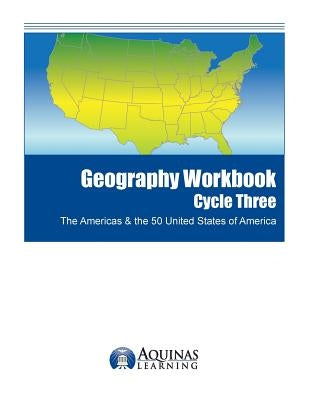
Black outline maps included in the book are: World Robinson Projection, North America with countries, Canada with provinces, United State of America with states, Central America with countries and South America with countries. The book includes all 50 US states: Alabama, Alaska, Arizona, Arkansas, California, Colorado, Connecticut, Delaware, Florida, Georgia, Hawaii, Idaho, Illinois, Indiana, Iowa, Kansas, Kentucky, Louisiana, Maine, Maryland, Massachusetts, Michigan, Minnesota, Mississippi, Missouri, Montana, Nebraska, Nevada, New Hampshire, New Jersey, New Mexico, New York, North Carolina, North Dakota, Ohio, Oklahoma, Oregon, Pennsylvania, Rhode Island, South Carolina, South Dakota, Tennessee, Texas, Utah, Vermont, Virginia, Washington, West Virginia, Wisconsin and Wyoming in the order they entered the union.
Also included are US territories: Guam, Saipan, Northern Mariana Islands, Puerto Rico, and the United States Virgin Islands.
The blank outline maps in this handbook can be freely photo copied by a teacher, mentor or parent for use in a classroom or in the homeschool.
Author: J. Bruce Jones
ISBN-10: 1500714518
ISBN-13: 9781500714512
Publisher: Createspace Independent Publishing Platform
Language: English
Published: 08/01/2014
Pages: 126
Format: Paperback
Weight: 0.68lbs
Size: 11.00h x 8.50w x 0.27d
Bruce is the developer of the World of Maps editable clip art map collection for PowerPoint and Adobe Illustrator for presentations, illustrations, graphic design, education and websites. Distributed through various websites including; www.mapsfordesign.com, www.bjdesign.com and Amazon. He is also the developer of Antique and Historical Maps, a collection of royalty free, antique digital maps from 1500s to the 1900s, used for graphic design, illustration, web sites and education.
This is Bruce's third book for Aquinas Learn and continuities the geography series. The previous books are Geography, The Americas & The 50 US States: Outline Maps of the America and the 50 United States States, with Names, Major Cities and Blank Outline Maps and Geography Workbook Cycle One, Africa, Middle East & the Holy Land.
Thanks for subscribing!
This email has been registered!
Take 20% off your first order
Enter the code below at checkout to get 20% off your first order