


Before you leave...
Take 20% off your first order
20% off
Enter the code below at checkout to get 20% off your first order
Discover summer reading lists for all ages & interests!
Find Your Next Read
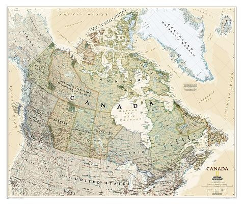
The Executive political map of Canada is a striking example of the cartographic excellence National Geographic is known for. This map features an attractive antique-style color palette, stunning shaded relief, thousands of place names, accurate political boundaries, national parks, archeological sites, and major infrastructure networks such as roads, airports, canals, and railroads. In addition to Canada, coverage includes Iceland, Greenland, and the northern United States.
The map is encapsulated in heavy-duty 1.6 mil laminate which makes the paper much more durable and resistant to the swelling and shrinking caused by changes in humidity. Laminated maps can be framed without the need for glass, so the frames can be much lighter and less expensive.
Not available to be shipped via Media Mail
Thanks for subscribing!
This email has been registered!
Take 20% off your first order
Enter the code below at checkout to get 20% off your first order