


Before you leave...
Take 20% off your first order
20% off
Enter the code below at checkout to get 20% off your first order
Discover summer reading lists for all ages & interests!
Find Your Next Read
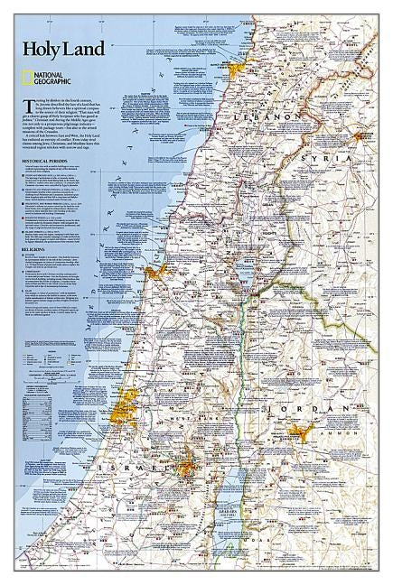
National Geographic's Holy Land wall map provides a fascinating in-depth look at the faiths, peoples, and politics that have shaped this historic region. This detailed political map is overlayed with facts about significant religious sites. Information on Judaism, Christianity, and Islam, as well as historical periods from the Stone and Bronze ages to the Islamic period through 1917 make this as much an educational tool as an attractive work of cartographic art. Cities, bodies of water, geographical features, ruins, Israeli settlements, and more are noted, as are transportation infrastructure such as highways, roads, railroads, canals, and airports. Coverage includes Lebanon, Syria, Jordan, and Israel.
The map is packaged in a two inch diameter tube with a label showing a thumbnail of the map with dimensions and other pertinent information.
Not available to be shipped via Media Mail
Thanks for subscribing!
This email has been registered!
Take 20% off your first order
Enter the code below at checkout to get 20% off your first order