


Before you leave...
Take 20% off your first order
20% off
Enter the code below at checkout to get 20% off your first order
Discover summer reading lists for all ages & interests!
Find Your Next Read
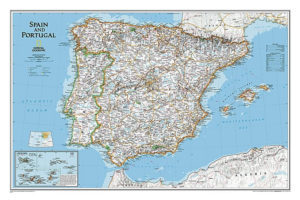
The signature Classic style wall map of Spain and Portugal features a bright color palette with blue oceans and the country's terrain detailed in stunning shaded relief that has been a hallmark of National Geographic wall maps for over 75 years. The map includes thousands of place names, accurate boundaries, national parks, and major infrastructure networks such as roads, highways, airports, ferry routes, and railroads. Coastal bathymetry is shown with depth curves and soundings. Spain's Balearic Islands in the Mediterranean are included. Inset maps provide detail of the Madeira Islands, Azores, and Canary Islands, as well as their location in relation to Spain and Portugal.
The map is packaged in a two inch diameter tube with a label showing a thumbnail of the map with dimensions and other pertinent information.
Not available to be shipped via Media Mail
Thanks for subscribing!
This email has been registered!
Take 20% off your first order
Enter the code below at checkout to get 20% off your first order